When looking at the landscape of climate change in the literal sense, we are faced with the advent of severe weather cycles, destructive storms like hurricane like Sandy and rising sea levels threatening to consume vast areas. City and state planners have their work cut out and are using technology to discover future crisis scenarios and their solutions.
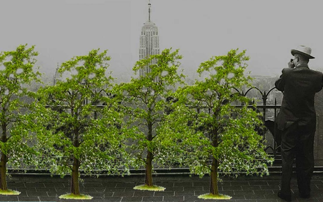
At VERGE in San Francisco, techniques using digital mapping were shown as an effective means being used by the City of Vancouver to identify where to address climate change. They were able to use technology to help map heat problem areas in different zones in order to plant thousands of trees to offset temperature rise and overheating, a leading cause of death in urban areas.
In addition to extreme heat planning, flood risk assessment is a big part of green infrastructure to mitigate risk. This includes Vancouver modifying urban design to accommodate rising oceans, which may include new zoning laws requiring new buildings in coastal zones are built three feet off the ground.
How has Vancouver been able to identify the dizzying number of changes to be made and then narrow them down to an actionable To Do list? By using sophisticated digital visualization combining data with intricate scans of the city using lidar, a detailed laser scan enabling a 3D view of a city within inches including size of trees, altitudes and nuances for the low cost of about $100k. Lidar scans are proving to be a must have for any smart urban planner to discover flood zones.
By seeing where flood areas are through digital visualization, urban planners can more accurately project where they need to build, what areas to fill, where to dig canals and other proactive changes to mitigate the flooding they believe will occur.
Not having visualization tools can result in ineffective building and investment. Prior to the current data visualization methods, The City of Vancouver spent over $10 million on a new sea wall that was damaged in the last major storm. If they had used these tools, they would have been able to anticipate this issue and would have built the wall a few feet higher.
Yet, it is much more than seeing a seawall, but an integrated system to allow cities to continue to function. Floods touch every part of a city, and affect multiple functions of urban communities. In the case of sewage overflow–the pumps just can’t handle more than a little overflow they were designed to process during a storm. In the case of flooding, the infrastructure that exists today just doesn’t cut it.
The State of California is also interested in risk mitigation and investing in preventative approaches. California is now exploring how to manage the costs and affects to coastal real estate. Places where rivers meet the ocean are exceptionally vulnerable, requiring higher walls or simply redesigning with floods in mind.
Sea level rise data developed in collaboration with the California Academy of Sciences are one tool the State is using to provide rules of thumb to guide regulations to address floods.
Since the effects of hurricane Sandy, local government has a sober view on the possible fallout of the insurance industry to meet the possible disaster impact. The City of San Francisco is also taking a more detailed look at how different funds will be able to address further the economic impacts of flooding.
Being able to look at climate change within specific communities enables government to also see where attention needs to be placed, such as addressing extreme heat days for inland communities like Riverside or flooding for coastal communities.
With 12 million more people moving to urban areas in the next decade, emissions are another important consideration.
Zero emissions is the mandate for public transportation and energy in California. The fact that we will see the effects of climate change for thousands of years to come, California is getting aggressive to accomplish transformational change as part of their current mandate.
Documents on the state level to support and plan includes a long list of a variety of adaptation action plans, collaborative think tanks, as well as a paradigm shift in the planning process. Rather than planning for the future based on the past, they are “planning for the future based on the future”.
Funding is scant, and that is not good news. The Kresgi Foundation has been the biggest support regional collaboratives in California, as well as Detroit, and other foundations have been incredibly supportive and stepping up to the plate. The recent Cap and Trade law has revenue coming into the State this year, but can only be used for efficiency versus adaptation.
The bulk of adaptation will be addressed by regional areas as a part of their goal to provide as much information as possible to allow for planning. This information network is resulting in regional collectives to stop overlap in efforts and provide knowledge share.
Adaptation and resiliency is a new focus for government, and collaboration is critical to addressing these goals.
California has developing systems in anticipation through the California Governors Office of Planning and Research, Climatechange.ca.gov. In the United States, ResilientAmerica.org has gained commitments from over one hundred mayors to address these issues.
On a global level there are two networks worth noting working on climate change. ICLEIUSA.org has a network of over one thousand member cities. Another collaborative network called C40 Cities Climate Leadership Group made up of cities around the world.
________________
LEARN MORE
Special thanks to VERGE and for the GreenBiz conferences happening globally to help illuminate our paths to sustainability.
To attend VERGE, visit http://www.greenbiz.com/topic/verge
Follow us Twitter.com/NobleProfit
Like us on Facebook.com/NobleProfit
Register at NobleProfit.com to gain valuable insights in related topics
To syndicate this content visit our channel on CSRwire
Noble Profit is brought to you by Creative Entity Org and Creative Entity Productions created by Amy Seidman.
 Noble Profit™ is an authentic source for discovering innovation, trends and investment in clean tech, and sustainable business.